ECHLGF Home
Tasks ans Rules
Map and Hotels
Registered pilots
Picture gallery
Results
ECHLGF 2003 archive
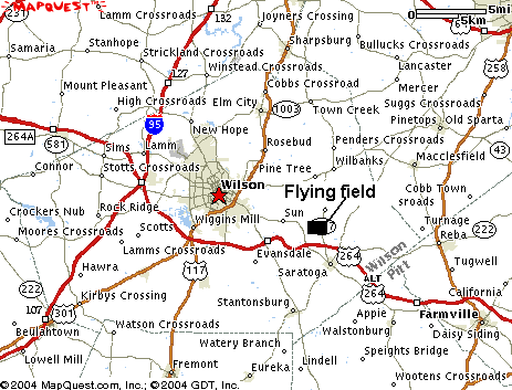
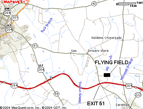
The field is located about 4-5 miles from Wilson, NC, at the intersection of hwy 264 BYP and Rt 91. NOTE: The section of Rt 91 between ALT 264 and 264 is marked as ALT 264 on the roads everywhere due to the previous construction and re-routing of 264!
If coming from Raleigh (RDU airport) or from hwy I-95, take 264 bypass and go around Wilson from the south. Take exit 51 and turn left to cross over the highway 264. After crossing the highway bridge immediately turn right onto a gravel road that will take you to the flying field.

If coming from Wilson, follow 264 ALT about 2 miles to Rt 91, turn left onto Rt 91. NOTE: The section of Rt 91 between ALT 264 and 264 is marked as ALT 264 on the roads everywhere due to the previous construction and re-routing of 264! Follow Rt 91 for 2-3 miles, it will start up a rise to bridge over hwy 264. At that point there will be a left turn that goes to a gravel road. Follow the gravel road for 1/2 mile through the farm land to the field.

Wilson Area Motels: